Maps - Buxton, Consol, Haydock and Muchakinock
Buxton, Consol, Haydock, Bucknell and Muchakinock Iowa relative location to major highways map.
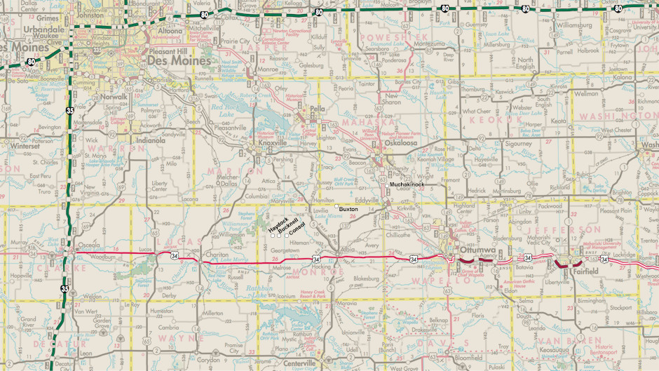
This map is a D.O.T. map with Haydock, Consol, Bucknell, Muchakinock and Buxton Iowa marked along the major highways for relative location.
Buxton, Consol, Haydock, Bucknell and Muchakinock Iowa county road map and auto tour.
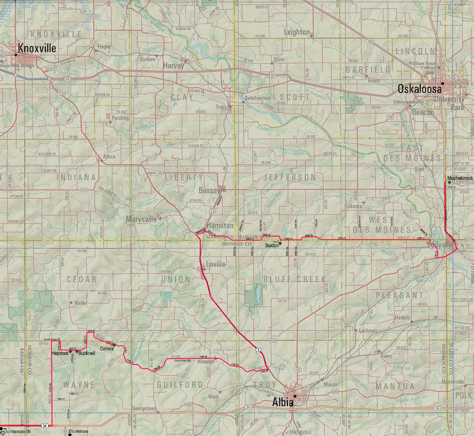
This is a county road map with Haydock, Consol, Bucknell, Muchakinock and Buxton Iowa marked with an auto tour route indicated. Click here for a full size printable map to take on your auto tour.
1900's Buxton Iowa Plat Map Overlay on 2014 Satellite Photo with East Swede Town Location Markers
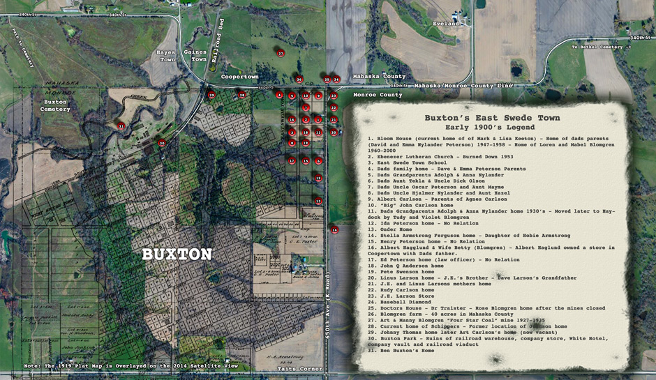
This map is an overlay of Buxton Iowa's plat map around the 1900's with East Swede Town locations marked. The base map is a 2014 satelite photo.
Buxton Iowa 2014 Satellite Photo with 1900's East Swede Town Location Markers
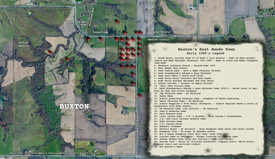
Similar to the Buxton map with overlay is the Buxton Map using a 2014 satellite photo without the plat overlay and includes Buxton's East Swede Town location markers.
Buxton Iowa 1919 Coal Mining Camp Plat Map
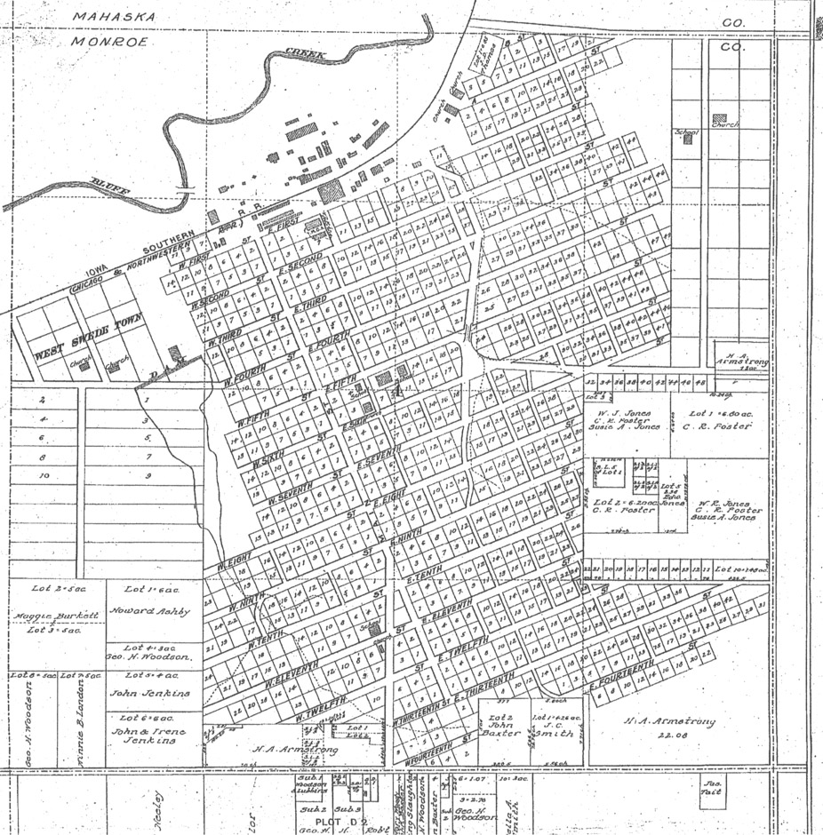
Buxton Iowa plat map from the 1900's.
Bucknell and Haydock Iowa Map with Location Markers
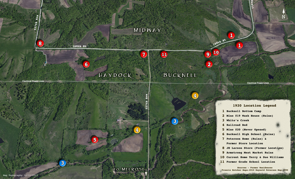
2014 Satellite photo map with 1920's location markers for the mining town of Bucknell and Haydock, Iowa.
Consol Iowa Map with 1920's Location Markers
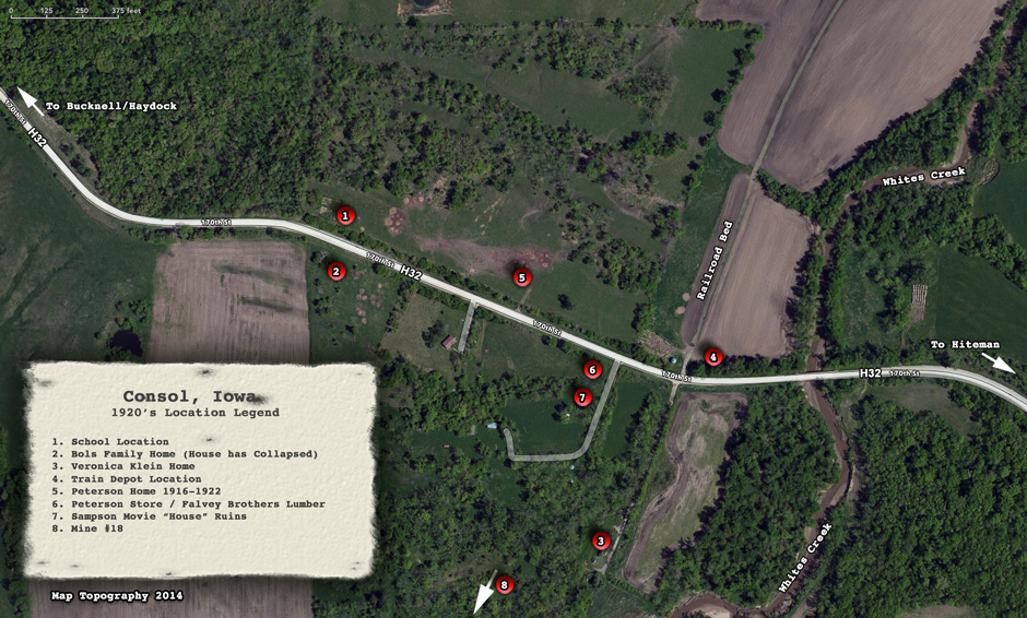
2014 Satellite photo map with 1920's location markers for the mining town of Consol, Iowa.
Francis Butcher Map of 1920's Bucknell / Haydock Iowa
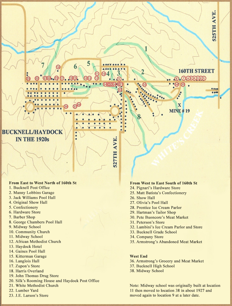
An illustrated map with location labels of Bucknell / Haydock, Iowa in the 1920's by Francis Butcher.
Francis Butchers Map of Bucknell and Consol, Iowa
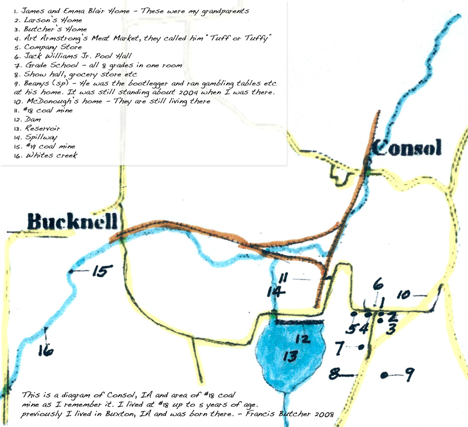
A hand drawn map with location labels of Consol and Bucknell, Iowa by Francis Butcher.
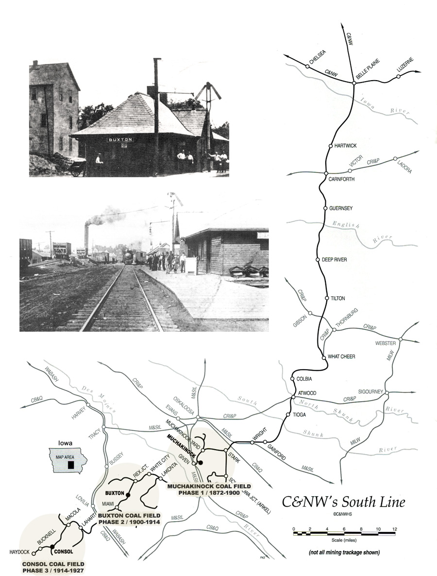
Consol Coal Fields Consolidation Coal Co.
(Superior Coal Company) 1914-1927
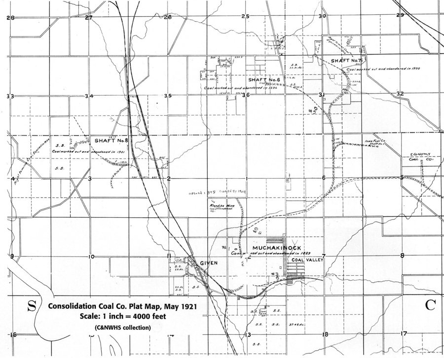
Muchakinock Coal Fields Consolidation Coal Co. 1872-1900
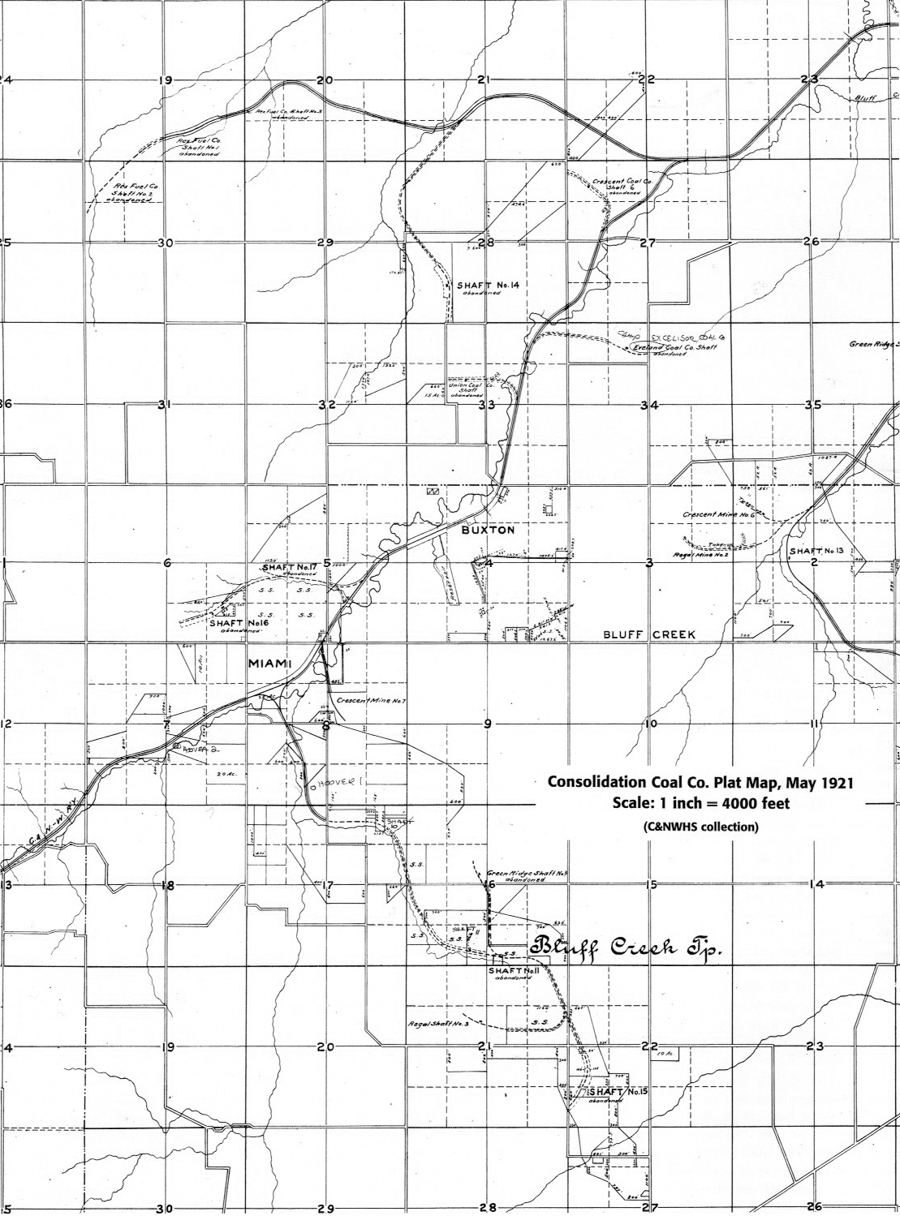
Buxton Coal Fields Consolidation Coal Co. 1900-1917
Consol Coal Fields Consolidation Coal Co.
(Superior Coal Company) 1914-1927
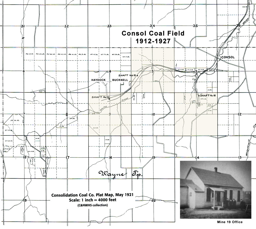
Mine Shaft #18 - South West of Consol 1 mile, section 11 on map.
Mine Shaft #19 located in Bucknell section 3 on map.
Mine Shaft #20 located in Haydock section 9 on map.
Consol Coal Fields Consolidation Coal Co.
(Superior Coal Company) 1914-1927

Muchakinock Coal Fields Consolidation Coal Co. 1872-1900

Buxton Coal Fields Consolidation Coal Co. 1900-1917

Four Star Coal Mine
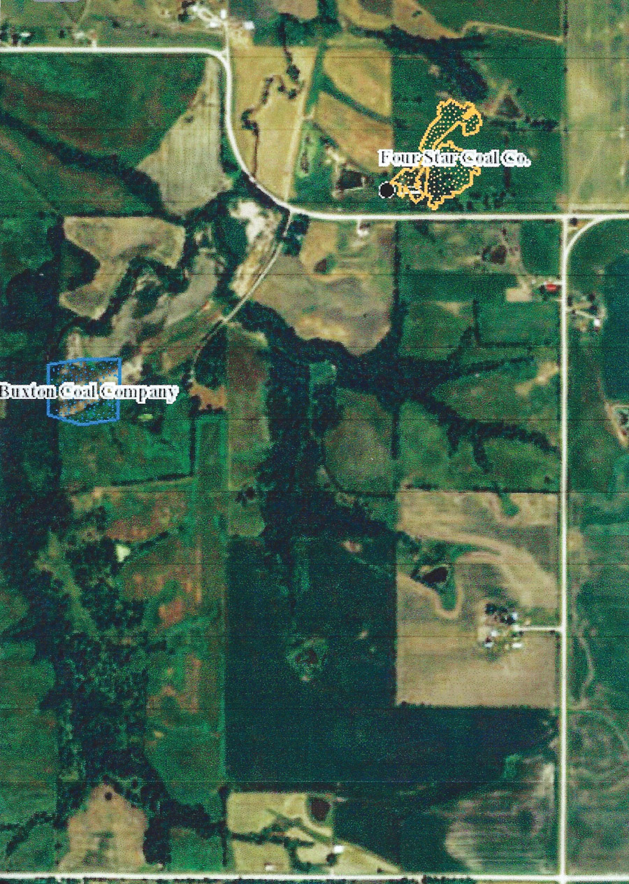
The gold outline is the underground location of the Blomgren Four Star coal mine as shown on the Iowa Mines website. The black dot is the entrance to the slope mine.The dark green pasture that sits above the mine is the original 40 acres of land owned by the Blomgren family in the early 1900’s and is now a cattle ranch owned by Dave and Liz Larson. The red dot is the location of the former Bloom house that is now owned by Mark and Lisa Keeton. The K road is the road running north/south(650th Ave) in northern Monroe County. The county line road between Monroe and Mahaska is the east/west road(340th St.). The mine is in Mahaska County. The Blomgren farmhouse and barn sat directly along the Country Line Road approximately half way between the property lines.
