http://www.buxtoniowa.com • Consol, Haydock & Buxton Iowa, USA • 1871 - 2014
Buxton Iowa's, East Swede Town
Dad's Home Town
Buxton’s East Swede Town was and still is a very special place for me and my Dad’s family. It was my Dad’s (Reynold “Ray” Peterson) home town. Dad was born in Buxton’s East Swede Town to David and Emma (Nylander) Peterson in 1909. He was the second of ten children born to his parents. The name East Swede Town was appropriately named since in the time around when Dad was born that area of Buxton was mainly inhabited by those of Swedish descendant. Initially the majority of the them immigrated from Sweden in the 1880’s to Muchakinock and it’s coal fields just south of Oskaloosa.
After coal mines numbered 1-9 near Muchakinock were worked out around 1900, the Consolidation Coal Company that was owned by the Chicago and North Western railroad moved its coal mining operation to the Buxton coal fields starting with mine number 10, located two miles south and one mile west of Buxton proper in the Miami area. The Swedes in Muchakinock migrated, along with other miners, to Buxton. Adolph Nylander, my Dad’s grandfather, according to his obituary, was a leader in the settling and developing of Buxton especially East Swede Town. Even in the Muchakinock coal camp, the Swedes all congregated in an area called Swede Row.
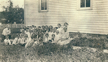
To the extent that the Swedes moved to Buxton from Muchakinock, they also moved the building for the Ebenezer Lutheran church to Buxton’s East Swede Town. The church was important to the Swedes and as a very religious group the church was the center of activity including Swedish schooling during the summer months. It was during that Swedish schooling that Dad learned to speak Swedish well as he retained that ability throughout his life. After the mines closed and most of the miners and their families had left the area,the church still remained as an active church in it’s East Swede Town location behind the Bloom house until 1953 when it burned to the ground.
Buxton proper was an approximate one square mile area in northern Monroe County that borders Mahaska County on the north. The area of Buxton that was East Swede Town is easily identifiable since most of the Swede’s lots were one acre or approximately the size of a football field as compared to the typical 1/4 acre lots for the other residential lots in Buxton proper. West Swede Town was located diagonally towards the southwest corner of Buxton as compared to East Swede Town being located in the northeast corner of Buxton. The various other ethnic locations throughout Buxton were somewhat arbitrary.
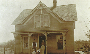
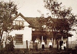
The Consolidation Coal Company owned all the property including the houses in Buxton proper with the exception being in East Swede Town where the Swedes owned their homes and paid rent on the land for the house. Those arrangements seem quite unusual. The Swedes’ houses were generally larger in size and varied in appearance from the standard company owned houses. Monthly rental for the houses was $7.00 per home including the lot and $.50 for a lot only. Living in a home in Buxton proper required the tenant to abide by the company’s strict rules for living there. Those rules included not allowing alcohol to be served in saloons or allowing any rabble rousing. Buxton was quite socialistic in many respects and remained unincorporated throughout it’s history.
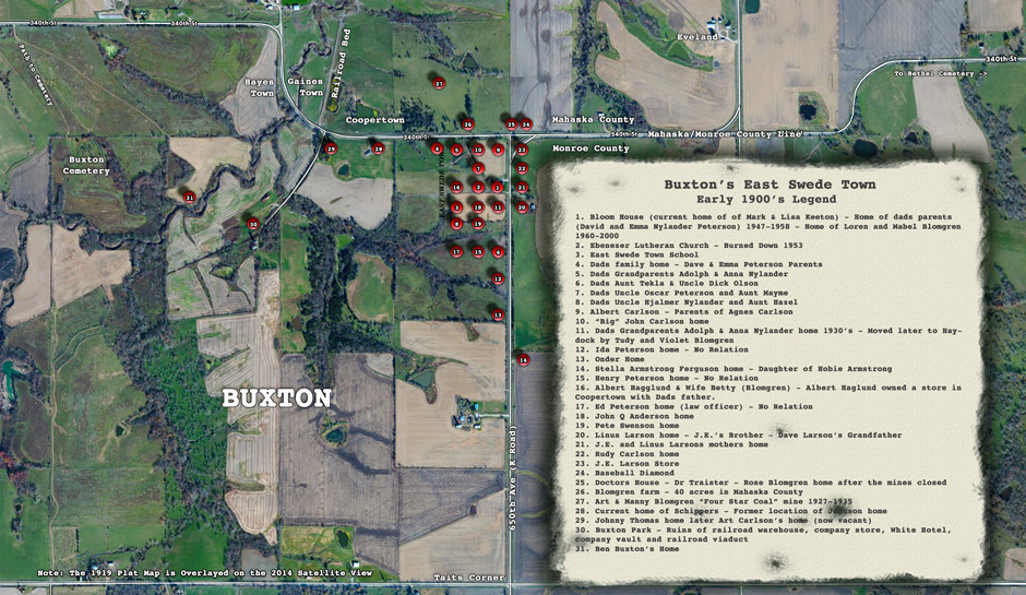
As one would expect, the areas outside of the borders of Buxton proper with less restrictions were developed. This was true for the land to the east and north of the area labeled East Swede Town in Buxton proper. The Larson and Armstrong families owned land east of East Swede Town across the K road(650th Avenue). Dave and Liz Larson still own that land over 100 years later. The Johnnes and Inga Blomgren family owned 40 acres to the north of East Swede Town across the Monroe/Mahaska County line road(340th St.) in Mahaska County. The Blomgren family farm later included a slope coal mine that was operated by Art and Manny Blomgren and was called the Four Star Coal Mine. Art also owned a bottling works with Carl Garrett. While not in the immediate area called East Swede Town, the areas across the roads owned by the Larsons, Blomgrens and Armstrongs were generally considered part of East Swede Town. Other so-called suburbs to Buxton included Coopertown, Gainestown and Hayestown to the north and Tait’s corners to the south.
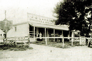
J.E. Larson’s store was located on the southeast corner of the “T” intersection of the K road and the County line road. Dad’s father worked in the Larson store after being injured in an mining accident when slate fell on him. He remained a cripple for the rest of his life. He later opened a grocery store in Coopertown with Albert Hagglund, the brother of his brother Oscar’s wife, Mayme. The store was in the same building as B.F. Cooper’s drug store. The store burned down in 1916 along with a number of other buildings in Coopertown.
The Doctors house as it was called was located in Mahaska County just north of the county line road at the “T” intersection with the K road. Dr. J.E. Traister purchased the land for the house from the Blomgren’s whose 40 acre farm was directly to the west of the Doctors house. Dad often mentioned Dr. Mater as a physician who practiced in and around Buxton including East Swede Town. Dr. Mater treated Dad’s older brother,Irving, prior to him dying at the age of 14 years of blood poisoning from stepping on a rusty nail while helping his Aunt Hazel and Uncle Hjalmer on their farm in Eveland. The farm was located across the road from the current hog processing plant that is in the area that was considered Eveland. Midwives were very common in Buxton for delivering babies. Mary Chambers a great aunt of Francis Butcher, a close friend of my dad, was a midwife who delivered hundreds of babies including my dads mother Emma in Muchakinock in 1887. There were a number of very prominent black Doctors in Buxton Including Dr. Edward A. Carter. Rose Blomgren lived in the Doctors house after the mines closed in the Buxton coal fields and most of the inhabitants including the Doctors had left the area.
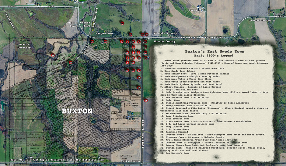
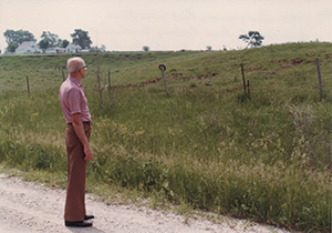
Dad and I returned to explore Buxton nearly every year until his death in 1993 to decorate the graves of many of the deceased family members buried in and around Monroe County. They included his grandparents Adolph and Anna Nylander in the Bethel Cemetery, three miles to the east of Buxton on 340th Street, the County line road. Dad laid out a map for me of who lived where in the East Swede Town the area. I am certain the map includes errors, although given a point in time Dad’s map is plenty accurate enough to give one an idea of how populated the area was and by whom. I also hope Dad’s map helps correct some of the other maps being distributed that contain many errors relative to East Swede Town.
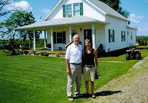
The membership for Ebenezer Lutheran Church is indicative of the residents of East Swede Town. Dad’s map showed the Carlson’s were very prominent in the town. Agnes Carlson wrote a history of her family in the area. She wrote about the Bloom family living next door in the current home of Mark and Lisa Keeton and having to walk through the Bloom’s yard to go to church, which was located directly behind the Bloom house. She mentions my Dad’s grandparents (Adolph and Anna Nylander) living at the time further south of the Blooms and receiving a newspaper from Sweden. Agnes’ family home was on the southwest corner of the current intersection of 340th Street and 650th Avenue. According to my Dad, the Rudy Carlson family also lived in a home on the east side of the K road between the Larson store and Linus Larson’s home. The mother of J.E. Larson and Linus Larson also lived in a home between the store and the home of Linus. Dad often talked about how the Swede men congregated along the ditch in front of the family home of Agnes Carlson parent’s to shoot the breeze on a Sunday afternoons.
I spent many summers in the 1950’s at the Bloom house after my grandparents purchased it in 1947. I remember that ticks were a big problem. I often wonder how men sitting along the ditch in the grass coped with the ticks.
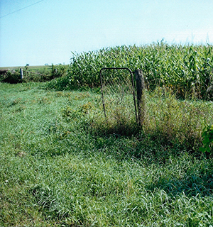
Agnes Larson, in her history, mentions the Onder’s lived south of them along the west side of the K road and across from Stella Armstrong Ferguson, the daughter of Hobe Armstrong. The Albia Union Republic newspaper published an article I wrote about where Stella Armstrong Ferguson lived along the east side of the K road and noted that the gate to her yard was still hanging there after 100 years. After the article was printed, a relative apparently came and removed the gate for a memory of Stella and Stella’s father Hobe, I believe the gate post is still there however.
The Onder residence was the approximate southern most point of East Swede Town. Dad’s aunt (his mother’s sister) Tekla and her husband Richard Olson and family lived along the west side of the K road between the Nylanders and the Onders. The only other road, if you wish to call it that, was the road that ran north and south in front of the Ebenezer Lutheran Church. There were a number of families who lived on both sides of that road/path. Since in the early 1900’s most transportation was horse and buggy, the roads were not as we think of them now. They were more like paths and as such horse and buggies were free to roam most any direction.
I do get a little out of my comfort zone when describing the location of the homes for the residences of East Swede Town. Obviously families moved and at any point in time the families occupying the various homes could be different. Dad’s map and articles by Agnes Carlson and Violet (Patterson) Bloomgren, Tudy’s wife, do give some credibility to the information I have presented.
Dad’s family lived in East Swede Town until 1916. They were one of the first families to start the migration from Buxton to the southwest 20 miles to the newly opened #18 and #19 mines in the Consol coal fields and the coal mining camps of Consol, Bucknell and Haydock. Those camps and mines too closed in 1927. After all the mining camps and mines were “Gone with the Coal Dust”, Dad’s parents maintained stores in Haydock and the Melrose corners until returning in 1946 to farm the very land that once was Buxton’s East Swede Town. They lived out their lives on that land until their deaths in the late 1950’s.
On my frequent visits to Buxton, it gives me a humble feeling to look out over the one square mile of fields and pastures that once was Buxton, whether standing at Tait’s Corners to the south, East Swede Town to the northeast or in “Buxton Park” to the northwest where the ruins of downtown Buxton still remain, and reflect on what life was like during the Coal Dust Era. I remember in the late 1940’s and early 1950’s spending summers from my home in Charles City at my grandparents when they lived in the Bloom house and farmed the land that once was East Swede Town. The cisterns of the miners old family homes were yet to be filled in as my sister Barb and I would search down through grandpa’s corn fields. The lot on the corner became grandpa’s pig lot with little evidence that it once was the location of Agnes Carlson and her parents family home.
It is during those moments, I remember all of my aunts and uncles, family friends and grandparents. I am especially thankful to my Dad for enriching my life before he died by answering my endless questions about the coal mining camps of Monroe County. Dad’s hometown of Buxton’s East Swede Town in a sense has become a hometown to me as well.
